RESEARCH
Base Line Data Collection

Area of intervention: Franschhoek and surrounding areas, Cape Winelands Biosphere Reserve
Timeline: 2017 – ongoing
About the project
The Cape Winelands Biosphere Reserve (CWBR) is an active member of the Upper Breede Collaborative Extension Group (UBCEG). UBCEG is multi-stakeholder platform that brings together agricultural practitioners, scientists, landowners, government departments and decision-makers along the Upper Breede River catchment.
UBCEG operates through thematic working groups, currently including:
1. Alien clearing and restoration
2. Land use and planning
3. Fire management
4. Maintenance and Management Plans
5. Stewardship Programmes
6. Water Quality Monitoring
7. Environmental Education
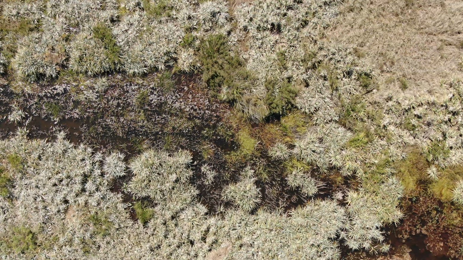
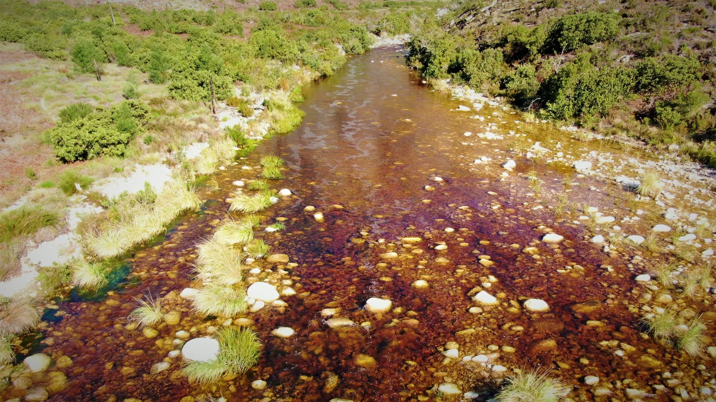
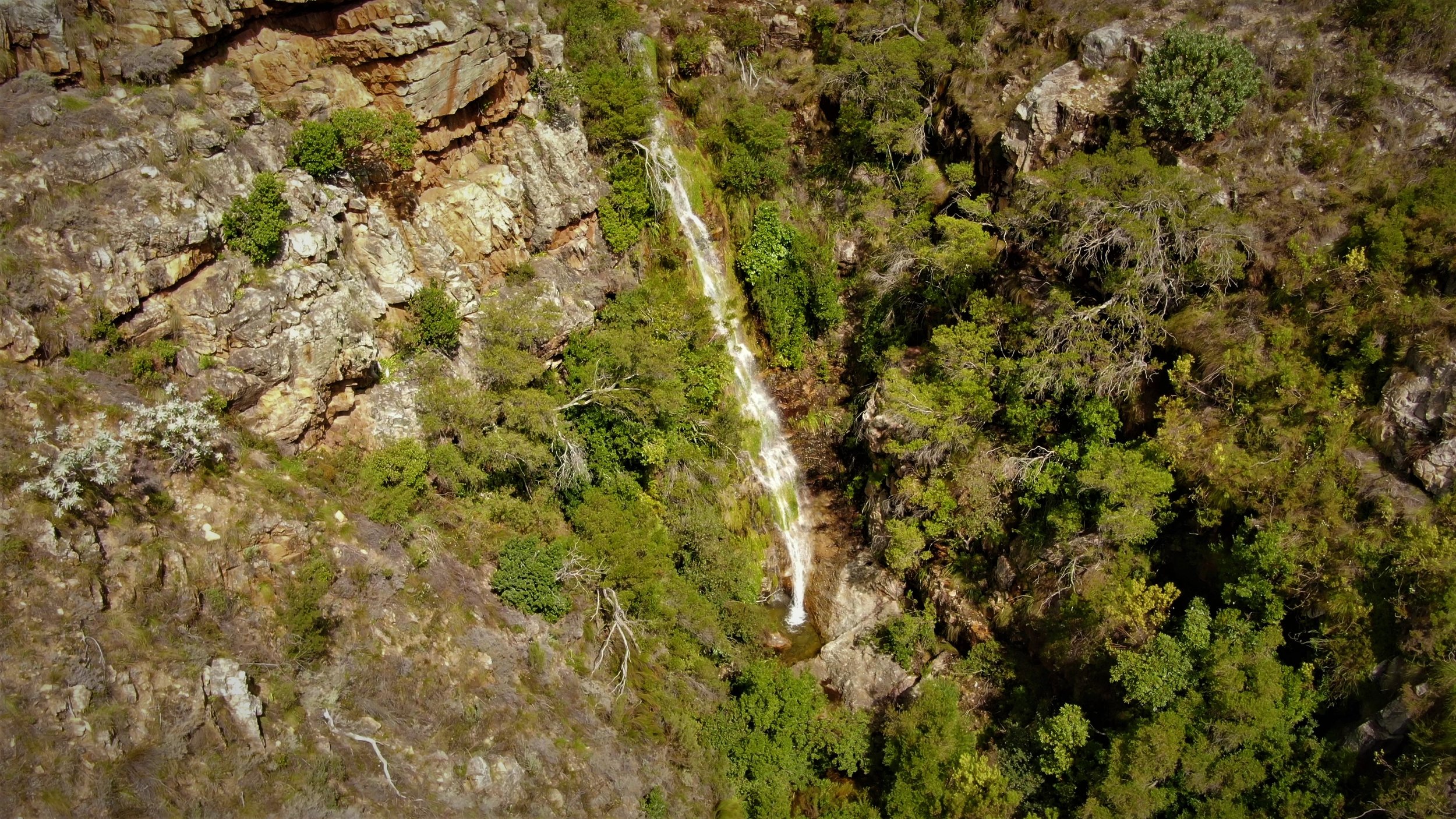
In 2017, the CWBR, in collaboration with UBCEG partners, identifies the added value of accessible, up-to-date baseline data in strengthening existing landscape-level research, conservation planning, and sustainable decision-making. The Baseline Data Collection project was established to contribute to environmental monitoring and protection through the use of innovative drone technology and open-source data sharing. High-resolution aerial imagery and spatial data are collected and made freely available to support monitoring, ecological restoration, environmental protection and sustainable development initiatives. In 2019, the project expanded through collaboration with the African Climate and Development Initiative (ACDI), positioning CWBR as a key research site and facilitating further partnerships.
Objectives
The project aims to:
· Foster a shared vision and coordination action for sustainable landscape management across the catchment
· Provide open-access baseline environmental data through a collaborative network of research partners and conservation initiatives
· Support universities, municipalities, conservation organisations, development practitioners and the public with reliable spatial data
· Strengthen partnerships with landowners, stakeholder and conservationists to enable responsible data collection across priority landscapes
Project activities
· Drown-based baseline data collection to support research and landscape initiatives
· Contribution to the Socio-Economic Benefits of Ecological Infrastructure (African Climate Development Initiative, 2019)
· Ongoing collaboration with UBCEG partners to align data collection with priority conservation and development needs
Further reading: Socio-Economic Benefits of Ecological Infrastructure (SEBEI)
The Conversation: Clearing alien trees can help reduce climate change impact on Cape Town’s water supply. Published: March 14th, 2022
The hydrological benefits of restoration: A modelling study of alien tree clearing in four mountain catchments in South Africa. Published February 3rd, 2022
Delving more into the research done - ScienceDirect: Mapping invasive alien trees in water towers: A combined approach using satellite data fusion, drone technology and expert engagement By Petra B. Holden , Alanna J. Rebelo, Mark G. New.
2020 Papenkuils Wetland Story Map - Department of Environmental Affairs and Development Planning
Story Map: Ecosystem Services of the Papenkuils Wetland
2021 Kluitjieskraal Wetland - Department of Environmental Affairs and Development Planning
Related Articles

